Permit Application Number: Issued at closure
Permittee:
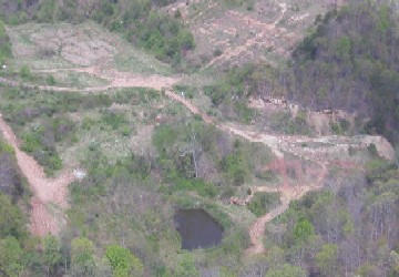
City of South Charleston
238 4th Avenue
South Charleston, WV 25303
County: Kanawha
Location: 3 miles east of I-64 crossing the Kanawha River at South Charleston. Accessible from SR 60 using Rock Lake Dr. Lincoln Dr. and CR 12 (Smith Creek) to a service road.
Latitude: 38º 21' 10.14" N
Longitude: 81º 45' 43.55" W
Closure Cap Area: 8 acres
Cost of Closure:
Number of Monitoring Wells: 3
Cap Type: Interim
Maps & Drawings:
•Location Map
•Design Drawing(pending)
•Landfill Images
•Landfill Monitoring Well Aerial Map
•Landfill Monitoring Well Topo Map
Closure Status:
The landfill closure cap is currently under design and scheduled for construction. The landfill closure cap is currently under design and scheduled for construction. Leachate is being transmitted by pipe line to South Charleston Waste Water Treatment Facility for disposal.
Return to the main LCAP page