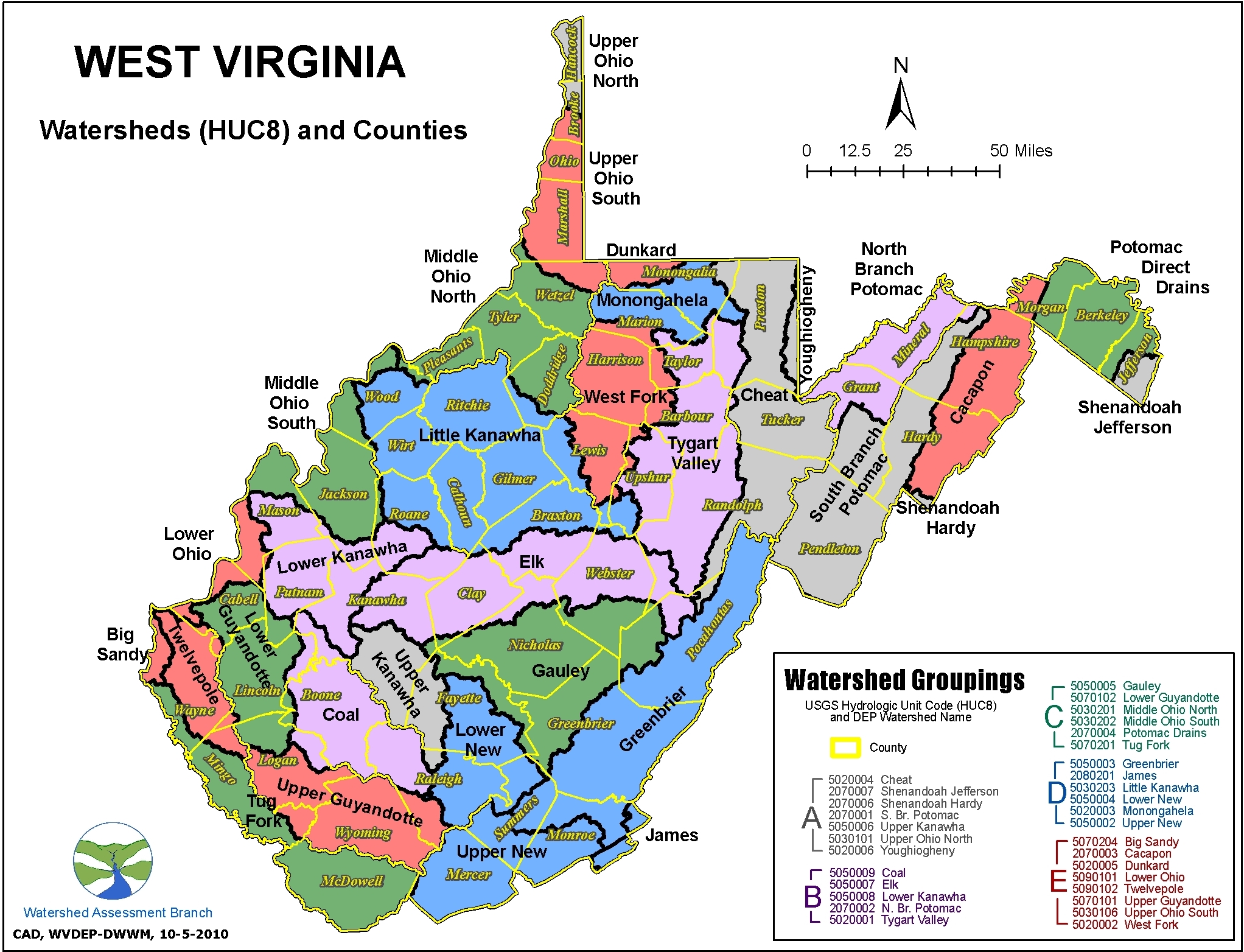
What is a watershed? After you learn what a
watershed is, It is important that you understand how to determine watershed boundaries and become familar with our state's
topographic maps. West Virginia has 32 watersheds divided according to hydrologic unit codes (HUC)
that contribute to the Chesapeake Bay and the
Gulf of Mexico. The waters west of the
eastern continental divide flow into the
Ohio River. The Ohio joins the
Mississippi River at Cairo, IL. The Mississippi flows into
the Gulf of Mexico at New Orleans, LA. The eastern continental divide also changes the course of five of our eastern rivers towards the
Potomac River. The Potomac flows into the Chesapeake Bay southeast of
Washington DC. A few streams in the southeastern corner of the state flow towards the James River.
Click-Here to view a Story Map that describes a selection of West Virginia's water bodies.

Mapping tools
Additional Resources